

Shallow Ford helped settle western NC
Now it's becoming a historic site
SCOTT SEXTON
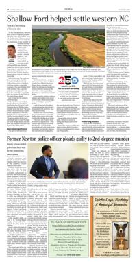
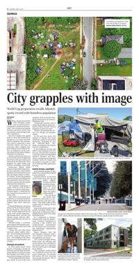
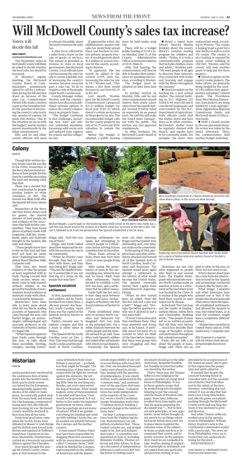
An aerial view of a millrace for a mill that was built on the yadkin river by Joe Biting in the 1830-40s, just downstream of the Shallow Ford. the land to the right (east) of the river is part of the future Shallow Ford State Historic Site, while land to the left (west) is private property.
To the untrained eye, which is likely to be the majority of motorists who cross the Yadkin River via Shallowford Road, a recent spasm of construction looks like the beginning of any number of housing developments dotting the countryside.
A crude entrance covered in chunky gravel — erosion control — was cut to allow heavy equipment access. A top layer of dirt and vegetation was removed, stakes laid out on a grid, and the beginnings of a parking lot were graded, making the 246-acre property look as if it's about to sprout a fresh crop of condos in Lewisville.
But in this case, the work has been ordered up by the N.C. Department of Natural and Cultural Resources as the first, and long overdue, step in the creation of the new Shallow Ford State Historic Site, a passive park of sorts designed to celebrate the state's first superhighway, also known in the 1700s as the Great Wagon Road.
Just in time for the nation's 250th birthday.
"The short version is that Shallow Ford was Grand Central Station for 170 years," said historian Marcia Phillips, who literally wrote the book "Historic Shallow Ford in Yadkin County" about a small part of the river that played an outsized role in settling western North Carolina. "To get anywhere in the west, everybody had to come through the Great Wagon Road, and (the ford) was the place you had to go to get to the other side."
Enormous significance
The spot is well known to anyone interested in American history.
The Shallow Ford, a rock-bottomed crossing, was a vital link on what was dubbed the Great Wagon Road, a frontier trail blazed by immigrants headed to western North Carolina in the mid-18th century, including the future in-laws of one Daniel Boone.
It was used by settlers, tobacco farmers and traders from about 1750 to 1920, when nearby highways and bridges opened to traffic.
A pair of historical markers, commissioned by the state government in 1938 and 1941, provides an overview.
Shallow Ford, the first reads, was a colonial route across the Yadkin River about 600 yards south of the bridge in use today.
"The ford, the Shallow Ford of historical significance — the current sign is incorrect about the distance, and the ford is actually about 1,000 yards from the bridge," wrote John Weaver, the administrator assigned to the new historical site. "We have a very good idea of where the ford is, as LiDAR (a tool that uses laser light for measurements) clearly shows where the historical roadbed was on either side of the river."
Geographic miscalculation aside, Weaver is correct in noting the significance of the crossing.
It was the scene of a 1780 skirmish in which British loyalists (Tories) were defeated by American Whig militia.
Some 15 Tories were killed, and only one Whig, Captain Henry Francis of the Virginia militia. His gravesite is nearby.
The ford, too, was the crossing used in 1781 by an army led by Lord Charles Cornwallis in pursuit of an American force commanded by Gen. Nathanael Greene. The armies would meet five weeks later in March 1781 at the Battle of Guilford Courthouse.
The second sign notes that Shallow Ford was the place where Union Cavalry under Gen. George Stoneman skirmished with the Confederates in April 1865 as Union troops moved across western North Carolina, destroying factories that supplied southern armies.
That's quite a bit of history for one low spot in the river.
Preserving history
Given all that transpired through a geographical quirk, it's natural that the state would take official note of it first by erecting roadside markers, and more recently, by earmarking money for the historic site.
The state purchased seven tracts of what was known as the Messick Farm property along Shallowford and Williams roads in 2022 for $2.17 million, with the intention of establishing the historic preservation site.
Local and state philanthropic groups raised $750,000; the state appropriated $1.8 million.
Language in the original budgeting bill said that the project would focus on "creating a major site for canoe camping, canoe access and passive outdoor recreation along the Yadkin River paddle trail." Land in hand, state officials announced an opening date in 2024.
Backers were excited that the project was finally taking shape.
But the projected opening date was pushed to 2025. Then nothing.
"They had the money," Phillips said. "We figured it would get done within a year. They weren't building Disney. It seemed feasible."
Whatever the holdup, work got underway in late spring. The parking lot and restrooms were first up, followed shortly by trail work and the installation of signs explaining the significance.
"We are on track to open Shallow Ford to the public this July," wrote Terra Schramm, a public information officer with the state Department of Natural and Cultural Resources, in an email.
The exact date has yet to be determined, but opening a new park around a low spot on the Yadkin River that played a major role in settling western North Carolina around the nation's 250th birthday sounds just about right.
Scott Sexton has been a bemused observer of daily life — and occasional thorn in the side of elected officials — in Winston-Salem since 2005. ssexton@wsjournal.com 336-727-7481 @scottsextonwsj
America at 250: The story still unfolding
this story is part of an ongoing series exploring the 250th anniversary of the united States in 2026. Visit our website to read other stories in the series and share your own.